Finding your elevation on an Android device is easy, but it works a bit differently than on an iPhone. While Android doesn't have a single built-in altimeter app, you can use Google Maps to view terrain or download a free app for a precise, real-time reading.
Method 1: View Terrain Elevation in Google Maps
Google Maps is perfect for seeing the general topography of an area, but it won't show your live altitude as a number. Here's how to use its terrain feature:
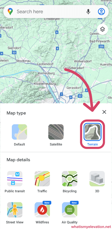
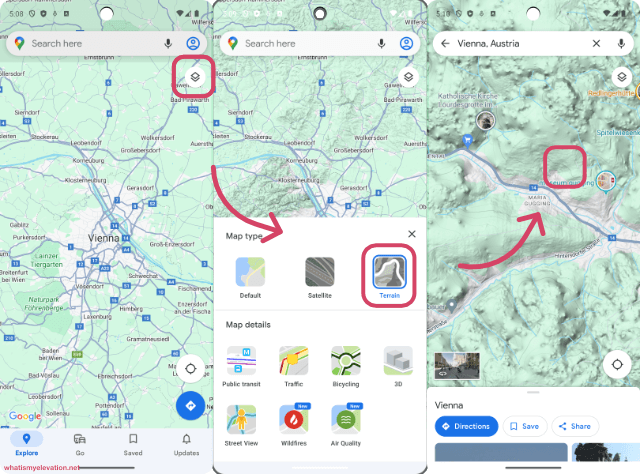
- Open the Google Maps app.
- Tap the Map Type icon (it looks like a stack of squares) in the top-right corner.
- In the "Map details" window, select Terrain.
- The map will now display contour lines and shading to show changes in elevation. As you zoom in on hills or mountains, you will see elevation numbers on the contour lines.
Method 2: Use a Dedicated Altimeter App (Recommended)
For a precise, real-time reading of your current elevation, the best solution is a dedicated altimeter app. These apps use your phone's GPS and/or built-in barometer to give you an accurate number.
- Open the Google Play Store.
- Search for "altimeter" or "my elevation."
- Choose a highly-rated app like "My Elevation" or "Altimeter GPS" and install it.
- Open the app and grant it location permissions. It will then display your current altitude, often with other useful information.
This is the most reliable way to get an exact number for your current height above sea level on any Android device.
Frequently Asked Questions
How do Android phones measure elevation?
They primarily use GPS data. Some higher-end models also include a built-in barometric pressure sensor, which provides even more accurate altitude readings by measuring air pressure.
How accurate is the elevation reading on my phone?
For most activities like hiking, running, or general curiosity, the accuracy is excellent, often within a few meters or feet. Accuracy can be slightly reduced in deep canyons or dense urban areas where GPS signals are obstructed.
Do I need an internet connection to check my elevation?
Not always. An app that relies purely on GPS can determine your elevation without a data connection. However, an internet connection can improve speed and accuracy by using assisted GPS (A-GPS).